This over bearing resemblance to SIMcity graphics offers perhaps a taster of the area GoogleMaps could advance to.
Obviously street map offers the possibility for actual images of houses, buildings, roads etc, so perhaps the cartoony style sampled in the article could be swapped for realistic images but still, it adds another dimension to maps.
It actually makes me want to look at the city in detail, it brings life. This in the least would be great for tourism.
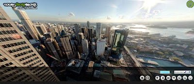
And on reading the new .net, it appears somebody has started doing close ups of cities: New York Aerial Virtual Tour and Syndey. Superb, hi def shots. It feels as if we're being spoilt after becoming used to the slightly weaker satellite images from Google maps.
It's like interactive Planet Earth.
@


No comments:
Post a Comment